Colorado National Parks
Comanche National Grassland

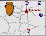
Comanche National Grassland covers over 435,000 acres in the southeastern corner of Colorado. 150 million years ago, the grasslands were home to dinosaurs. In 1749 - 1805, the land was home to the Comanche Indian Tribe. After they left the land, it became grazing land for cattle ranchers until 1898. The Santa Fe Trail also ran past these grasslands from 1821 - 1880. Since 1954, the US Forest Service has managed the land, and in 1960 it was designated as a grassland. Now the land is used for livestock grazing, wildlife habitation, recreation and mineral production. This grassland is split into two different areas, the Carrizo unit south of Springfield, on the border of Oklahoma; the Timpas unit south of La Junta.


The Picture Canyon Trail is located in the Carrizo Unit of the grasslands. This moderate trail runs through the grasslands providing views of many rock cliffs, as well as, abundant wildlife. Bird sightings are common, as over 257 species of birds inhabit the area. Some of the birds you might see are Say's Phoebes, Bullock's Orioles, Rock Wrens, Western Meadowlarks, Lark Sparrows, Mourning Doves and Red Headed Woodpeckers.
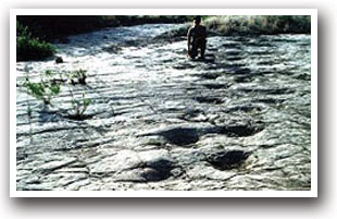
Be sure to visit the Picketwire Canyonlands. At these canyonlands, you will view dinosaur tracks. Dinosaurs roamed this area millions of years ago, in an area that was once a river. As the dinosaurs waded through the mud, they left over 1,300 tracks that later were buried and turned into stone. Rangers will give tours by appointment only. Tours are offered in April, May, June, September and October.
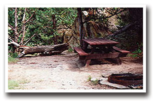
Other activities available in the grasslands are hiking, mountain biking and horseback riding on the many trails in the grassland. Scenic driving, picnicking and viewing historic sites are also popular. Prehistoric rock art, early homesteaders' rock huts, and limestone markers from the Santa Fe Trail are some of the exciting historic sites in the grassland. Bent's Old Fort is also nearby for more history.
Directions:
From Springfield: take on Highway 287 south for 17 miles. At County Road M turn right (west) and continue for 22 miles, then turn left (south) at Forest Service Road 539 and travel 1.9 miles to the parking lot.
From La Junta: take Highway 109 for 58 miles. Highway 160 east for 18 miles then County Road 3 turn right and go south for 7 miles. Turn left at County road P and travel east for 3 miles. At County Road 6 turn right and travel south for 2 miles, then turn right (west) at County Road M and continue 1-1/2 miles. Turn left (south) at Forest Service Road 539 and go 1.9 miles to the parking lot.
More Activities & Information
La Junta, Colorado includes: Bent's Old Fort National Historic Site, Branson, Las Animas


