Colorado Hiking & Backpacking Trails
The Colorado Trail
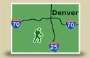
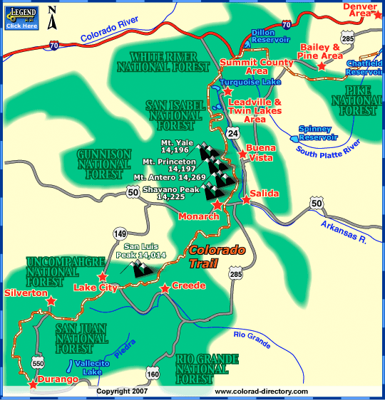
The Colorado Trail runs from Denver to Durango, nearly 500 miles through the Rocky Mountains, passing through eight mountain ranges, seven national forests, six wilderness areas and five river systems. The trail was built almost entirely by volunteers as a joint project between the US Forest Service and The Colorado Trail Foundation. The effort began in 1973 and the Trail opened on September 4, 1987.
The Colorado Trail is divided into 28 segments based on major access points. Trail users include hikers, backpackers, mountain bicyclists and horseback riders. Most of the Trail is non-motorized. Dogs are allowed on nearly the entire Trail except for the first 6 miles of Segment 1 where regulations benefit the bighorn sheep habitat. The Colorado Trail ranges in elevation from 6,000 feet to 13,334 feet with most of it above 10,000 feet. The Colorado trail meander through the following Wilderness Areas: lost Creek, Holy Cross, Mt Massive, Collegiate Peaks, La Garita and the Weminuche.
The entire 500 miles of The Colorado Trail takes an average of 4 to 6 weeks, hikers can choose to just hike a section for a wonderful 1/2 or full day hike.
More Activities & Information
Bailey & Pine Area, Colorado includes: Conifer, Grant, Pine, Shawnee
Buena Vista Area, Colorado includes: Johnson Village, Nathrop, St. Elmo
Denver Area, Colorado includes: Arvada, Aurora, Brighton, Broomfield, Castle Rock, Centennial, Commerce City, Elizabeth, Elbert, Englewood, Fort Lupton, Golden, Greenwood Village, Highlands Ranch, Hudson, Lakewood, Larkspur, Littleton, Parker, Westminster, Wheat Ridge
Durango, Colorado includes: Bayfield, Hesperus, Ignacio, Lemon, Vallecito Lake
Lake City, Colorado includes: Powderhorn
Leadville & Twin Lakes Area, Colorado includes: Granite, Twin Lakes
Salida, Colorado includes: Howard, Monarch, Poncha Springs
Summit County, Colorado includes: Breckenridge, Copper Mountain, Dillon, Frisco, Green Mountain Reservoir, Heeney, Keystone, Silverthorne
Hiking Trails in Colorado