
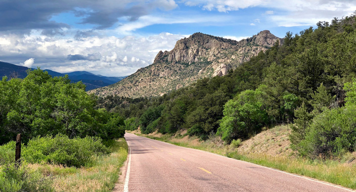
Welcome to Colorado, where our mountains sing, our prairies whisper, and our rivers roar!
Explore Colorado's Scenic Byways with a Local Touch
Since 1980, my family has helped Coloradans and visitors uncover the stories behind our state's most remarkable vacation destinations. In 1989, we embraced our first Scenic Byway, the Highway of Legends in South-Central Colorado. For us, these byways aren't just roads; they're living history lessons, where every bend reveals a patch of wildflowers, an old miner's cabin, or a mountain vista as timeless as Colorado's indigenous and pioneer roots.
Why Choose a Colorado Scenic Byway?
Colorado is home to some of the most breathtaking landscapes in the country, and there's no better way to experience them than by exploring our renowned scenic byways. In fact, my favorite way to pick a vacation destination is to choose a byway I want to explore! Our comprehensive Colorado Scenic Byways Map Section brings together the best routes for travelers seeking adventure, history, and natural beauty.
Colorado's Five Regions and Their Must-Drive Scenic Byways
Silver Thread Scenic & Historic Byway (Northwest Colorado): Travel 117 miles from South Fork's ranch land through Creede's mining legacy to Lake City's Victorian log cabins, then north past Powderhorn to Blue Mesa Reservoir west of Gunnison. The Silver Thread Scenic & Historic Byway weaves a living history beneath dramatic peaks where Ute and Apache families once hunted and held sacred ceremonies. Before Spanish traders mapped the Old Spanish Trail, these valleys echoed with the footsteps of Native peoples. Later, Hispano ranchers established irrigation canals beside the Rio Grande, and in the 1800s, mining entrepreneurs and railroad crews carved toll roads and rail lines through rugged canyons. Picnic at North Clear Creek Falls, where 100 feet of crystalline water thunders into granite pools. Explore Creede's Underground Mining Museum or discover tales at the 1870s stagecoach tollgate at Wagon Wheel Gap. Anglers and picnickers will linger, this sensory journey where the scent of aspen and wild rose mingles with the enduring legacy of Hispano ranchers and Spanish-trail traders.
Cache la Poudre-North Park Byway (North Central Colorado): Travel along Highway 14 from Fort Collins to Walden on the Cache la Poudre-North Park Byway, tracing the path of Colorado's only federally designated “Wild and Scenic River.” The route winds through granite canyons and past whispering cottonwoods, following a corridor rich in natural beauty and human history. For centuries, Indigenous peoples such as the Ute and Arapaho lived, fished, and traveled along these trout-filled waters. In the early 1800s, French-Canadian trappers famously cached their gunpowder on the riverbanks; a story that gave the river its name. Later, pioneers and settlers built irrigation ditches and trails that shaped the region's agricultural heritage. Today, enjoy river rafting, fishing for native trout, and hiking among pine forests, with interpretive signs and pullouts offering insights into the area's past. State Forest State Park near Walden provides family programs and abundant wildlife viewing, including chances to spot elk and moose.
Alpine Loop Backcountry Byway (Southwest Colorado): Journey through the heart of the San Juan Mountains on the Alpine Loop Backcountry Byway, linking the historic towns of Ouray, Silverton, and Lake City. Designed for high-clearance, four-wheel-drive vehicles, this rugged road ascends to Engineer Pass at 12,800 feet, where crisp mountain air mingles with the scent of pine and vibrant alpine wildflowers. Originally built by miners in the late 1800s, the byway now welcomes travelers into sweeping meadows and golden aspen groves, especially stunning in summer and fall. Highlights include American Basin's brilliant wildflower with blooming marsh marigold, Colorado columbine, larkspur, and more (PRO TIP: They peak from mid-July to early August). Interpretive signs and self-guided tour materials reveal the region's mining heritage and natural wonders. Don't miss Animas Forks, a remarkably preserved ghost town with original 19th-Century cabins and mill sites. For deeper exploration, guided Jeep Tours provide safe access to the byway's most scenic and historic sites.
Highway of Legends Scenic & Historic Byway (South Central Colorado): Follow an 82-mile ribbon of State Highway 12 between Walsenburg, the Cuchara Valley, Stonewall, and Trinidad, with a 35-mile detour over Cordova Pass via County Road 46. The Highway of Legends Scenic Byway traces paths first tread by Ute, Comanche, and Apache hunters beneath the Spanish Peaks. Later mapped by Spanish explorers and French trappers, the route was settled by Hispano ranchers who irrigated fields with river-fed canals. La Veta's Francisco Fort Museum is the only surviving adobe fort in Colorado it showcases artifacts from Ute, Jicarilla Apache, Comanche, Hispanic, and pioneer communities. In the 1800s, mining entrepreneurs and railroad crews carved through rugged canyons. Today, families are guided along the winding highway where the crisp alpine breeze at Cordova Pass carries whispers of early trappers, and gentle loops off the summit trail reveal panoramic vistas. Blue Lake beyond Cuchara beckons for lakeside picnics, while in Cokedale, visitors stand among over 300 beehive coke ovens, the largest surviving collection in Colorado, where interpretive panels animate the region's coal-mining saga.
Pawnee Pioneer Trails Scenic Byway (Eastern Colorado): Stitching 128 miles across the rolling plains of northeastern Colorado, the Pawnee Pioneer Trails Scenic & Historic Byway traces ancient buffalo-hunting and trade routes once used by Pawnee, Arapaho, Cheyenne, Comanche, and Kiowa peoples through the sweeping Pawnee National Grassland, corridors later widened by French and American fur trappers in the 1820s. As homesteaders and pioneers arrived, they dug irrigation canals, built sod houses, and, with the coming of the railroad, helped draw German-Russian and Mexican farmworkers to vibrant towns like Fort Morgan and Sterling. Along the way, travelers encounter the dramatic sandstone towers of Pawnee Buttes, panoramic views of shortgrass prairie, and the bird-rich Crow Valley Recreation Area, where over 250 species fill the sky each spring and fall. Today, interpretive panels, hiking trails, and picnic spots invite visitors to explore the region's unique ecology and history. The Fort Morgan Museum and Sterling's Overland Trail Museum, together with their historic railroad depots, offer immersive exhibits and restored buildings that bring to life the stories of Native peoples, pioneers, railroad workers, and immigrant communities. These cultural landmarks invite visitors to experience diversity that has shaped Colorado's prairie heritage, from ancient migrations and buffalo hunts to the vibrant towns and traditions of today.
Plan Your Colorado Getaway
Start planning your ultimate Colorado road trip with our Scenic Byways Map. Whether you're after a romantic escape, a family adventure, or a solo journey into the wild, you'll find routes and resources tailored to every interest and budget. Each byway page features detailed maps, must-see attractions, and links to local lodging and activities; making it easy to customize your perfect itinerary.
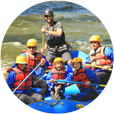
Our website doesn't just map the routes; it connects you with the best places to stay and play along the way. Find a wide variety of lodging options including: Cabins & Cottages, Motels & Hotels, Vacation Homes, Condos/Suites, Bed & Breakfasts, Tent Campground, RV Parks along with Colorado's Fun Things to Do: National Parks Monuments, Historic Sites & Fossils, Hot Springs, Whitewater Rafting, Horseback Riding, ATVing, Jeep Tours, Golfing, Fishing, and Hunting.
Colorado Vacation Planning - Cabins, Motels, Campgrounds, Vacation Homes, RV Parks
 Colorado Groups and Reunions
 Colorado Deals & Discounts
 Colorado Weddings and Elopements
Our Colorado Partners
Featured Colorado Maps
Explore Colorado's Towns by Region:
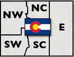
View Colorado Regions Map
Click Here For Current Colorado Road Conditions
Colorado Department of Transportation